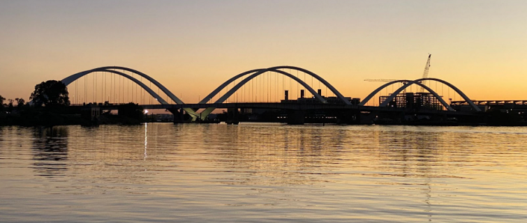
The bridge would be impressive anywhere, but it belongs to Washington, D.C.
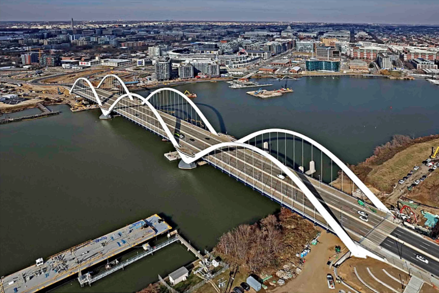
The most expensive infrastructure project ever built by the District of Columbia, it stretches 1,600 feet across the Anacostia River near Poplar Point, with six lanes of traffic carrying more than 77,000 commuters each day, and boasts the widest pedestrian and bike lanes of any bridge in the U.S.
And it is stunning, with its six white arches rising out of the water on either side as if supported by the river itself.
The Frederick Douglass Memorial Bridge, which opened in 2021, is all of these things and more—a metaphor for what Washington could become if a city riven by racial divisions and economic inequality, factionalism, longtime grievances, and often-vicious politics, could be made whole.
“Obviously, this is a work of infrastructure, but it carries enormous symbolism, and it will have an outsized impact on the communities living on both sides of the river,” says Uwe Brandes, faculty director of the Master’s in Urban & Regional Planning program at Georgetown University.
A Unifying Symbol
The symbolism works on several levels, beginning with the name, which honors the 19th-century author, orator, and abolitionist whose home sits on a bluff overlooking the river.
“Because it links Andrews Air Force Base to the White House, it is sometimes referred to as the ‘Presidents’ Highway,’” Brandes says. “So the bridge carries our democratic values out to the rest of the world."
Equally important is its local symbolism in a city with a long history of segregation. “For decades now,” Brandes says, “there has been a social justice-based movement to think about the river as a place where our city can be united, instead of being perceived as a line of racial and economic division.”
Brandes has personal knowledge of the bridge’s history, having spent the greater part of his career working on the project. He moved to Washington in 2000 to manage the Anacostia Waterfront Initiative (AWI) for the administration of then-Mayor Anthony Williams and continued as a consultant after moving to the Urban Land Institute in 2007 until coming to Georgetown University in 2013, where he has been since.
“Thousands of planning, design, and construction professionals worked collaboratively to transform an aspirational ideal into physical reality,” Brandes says. “It has been a labor of love.”
A Decades-Long Partnership
Created in 2000, the AWI is a partnership between the District of Columbia and more than a dozen federal agencies that manage land along the seven-mile stretch of the river running through the District. Its many completed projects include improving the Anacostia’s water quality; transforming hundreds of acres of parkland to make it more inviting and accessible; and building more than 15,000 units of new affordable and market-rate housing to anchor cohesive neighborhoods on both sides of the river. The new bridge is part of a $906 million project launched in 2012 to replace the original four-lane structure, which opened in 1950 and was deteriorating.
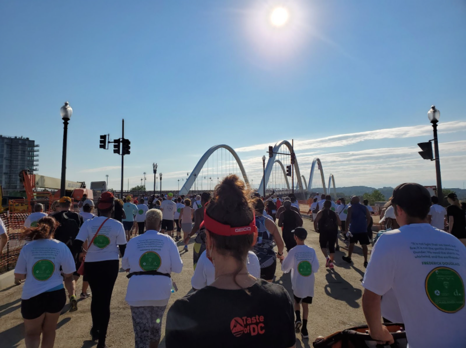
The bridge’s grand opening in September 2021 marked a symbolic milestone, but the larger project continues. Construction continues on the roads approaching the bridge on both sides. And there is more planned for advancing equitable development in neighborhoods that Brandes says housed some of the largest redevelopment projects of the urban renewal era of the 1960s and 1970s, when public housing was concentrated in isolated enclaves.
At the local level, the bridge symbolizes an inclusive and just vision for community development, positioning the Anacostia as the center of 21st-century Washington, D.C. The initiative has sparked housing growth on both sides of the river, particularly in the area surrounding Nationals Park and the District Wharf, but also in Historic Anacostia, Fairlawn, Kenilworth, and Deanwood.
As a result of this growth, the boundaries of Wards 7 and 8 have been extended across the river, picking up more affluent areas near Nationals Park and giving these wards more political and economic clout.
“It’s just a huge, historic shift to have the ward cross the river and not just be able to say that the other side of the Anacostia River is outside the realm of new development,” says Glenn Williamson, faculty director for the Georgetown Master’s in Real Estate program. “If you were to drive out Suitland Parkway, you would see Sheridan Station and other award-winning projects from WC Smith like their City View, which was named Innovative Project of the Year by the U.S. Green Building Council. And the fact that now Ward 8 extends on both sides of the river—it’s chipping away at this boundary.”
In the mid-2000s, when Williamson’s firm, Amber Real Estate, served as an advisor to the Anacostia Waterfront Corporation and later to the Deputy Mayor for Planning and Economic Development, many of the AWI projects that are now completed (The Wharf) or underway (Hill East, Kingman Island) sounded almost “pie in the sky,” Williamson says. “But so many things have moved forward. The new bridge helps to define the proposed site for Poplar Point, where greater density along the east side of the Anacostia could someday mirror the developments already completed along the western edge. If you look ahead another 20 years and see what’s going to happen, I think, ultimately, it’s very encouraging.”
“The central theme of the whole Anacostia Waterfront Initiative was that the river would unite, not divide,” Williamson says. “You want to have people feel like they’re part of the same city.”
Learn more