The study is small, but its results are encouraging. After analyzing transportation and economic data from nearly a mile of K Street, within the Mt. Vernon Triangle neighborhood in Washington, D.C., Josiah Blackwell-Lipkind, a 2024 master’s candidate in the Urban & Regional Planning program at Georgetown University, found that replacing on-street parking and some automobile travel lanes with bike lanes not only increased bicycle traffic but spurred economic activity in the neighborhood as well.
Yet this research exercise represents much more than a brief, if promising, analysis of eight city blocks. It is one of the university’s first uses of a new urban data platform called Replica. The proprietary platform utilizes artificial intelligence to piece together thousands of pieces of anonymized cell phone and vehicle GPS records to enable urban planners to tackle problems that were once nearly impossible to solve without conducting costly manual traffic studies or using oversimplified traffic models that do not account for real-world human behaviors.
“For a long time, travel surveys and resulting travel models were used for transportation behavior studies and planning decisions,” says Blackwell-Lipkind, who also works as an urban planner for the U.S. Department of Transportation. “What’s happening now is, instead of conducting these types of intermittent surveys every few years, there’s a push to use more live data based on real-world activity. Pings from GPS and phone data can tell us where people are actually going throughout the day.”
Replica, which was founded as part of Alphabet in 2017 and is now an independent company, combines privatized cell phone-generated location data together with information from the U.S. Census Bureau and other public travel surveys “to build out an entire population,” Blackwell-Lipkind says. “Replica creates a synthetic population of people using the GPS data from a sample of people.” This mobility data enables users to determine not just regional traffic patterns but the demographic characteristics of trip takers as well.
An Evolving Neighborhood
The Urban & Regional Planning program piloted Replica in the summer of 2023 in its Planning Studio course, which examined the community development issues in the broader area known as Downtown East. “Our students are interested in new sources of data which relate directly to real-world challenges,” says Uwe Brandes, Faculty Director of the program. “Our partnership with Replica enabled students to critically explore the utilization of one of the most cutting edge urban planning tools on the market, one which is being rapidly adopted by professionals in the field.”
In early 2024, the planning program entered into a demonstration agreement with Replica that allows the company to use the program “as a kind of testbed for the software,” Brandes says. The agreement enabled students in the course to use the software. The demonstration with the Urban Planning Program was so successful that Georgetown has now made the tool available to all students in the entire university.
“It’s a very fine-grained source of data that urban planners have typically not been able to access unless they manually collected the data themselves,” he says. “The practice of urban planning is changing very rapidly. AI-enabled data sets are not widely adopted and there is some level of skepticism associated with the algorithms producing this data. But what better than an academic setting for asking critical questions like, ‘Should we be using artificial intelligence in this way?’”
A ‘Fantastic Opportunity’
Izzy Youngs, a program alumna and visiting lecturer in the planning program and Blackwell-Lipkind’s advisor on the project, believes the answer will be a qualified “yes.”
“One of the reasons it’s so important to introduce this application into an academic setting is because we can really honestly engage with what kinds of questions are not suitable to be answered with this kind of data; and what kinds of assumptions and data quality issues there might be which bias the data or results,” says Youngs, who also works as a civic data analyst at Alta Planning + Design.
That said, introducing Replica to students “is a really fantastic opportunity” that puts Georgetown “at the front edge of what’s happening in the field,” Youngs says. “I don’t know of any other universities or schools that have partnerships like this. And I think the ability for students to access this kind of data is going to be so important not just for their education but for their professional development” because a lot of companies are looking to hire people who have worked with this technology.
Replica data can help answer questions that go far beyond the scope of traditional travel demand models. For example, traditional models do not take into account that people often take trips in a chain, Youngs says. Rather than going from Point A to Point B and back again, they may drive from the office to the grocery store, to the pharmacy, and to the school to pick up their children. Replica documents each of these individual trips.
Mobility data can also be useful in other fields, such as public health. Health agencies could use Replica to see how travel patterns changed for different demographic groups during the pandemic and then use this data to target outreach campaigns. That’s because the data can show how different users tend to move during the day.
A Surge in Bicycle and Economic Activity
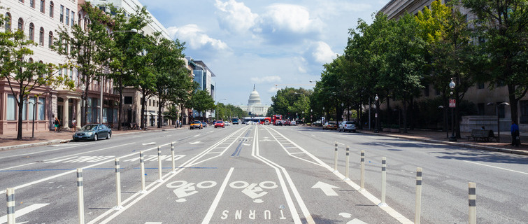
Blackwell-Lipkind’s study examined K Street between Seventh Street NW and First Street NE. This is the site of a 2021 District Department of Transportation project that replaced on-street parking and vehicle travel lanes with protected bike lanes. K Street now has the only east-west protected bike lane in the area. Between the years 2019 and 2021, Blackwell-Lipkind found that bike trips increased 350 percent relative to nearby corridors, accidents per trip for all travel modes declined, and vehicular traffic was only marginally affected. But perhaps the biggest surprise was business sales, which outpaced the District of Columbia average by 200 percent.
Did the addition of bike lanes help cause this surge? That’s what the data suggest, Blackwell-Lipkind says, but he adds that more research will need to be done. And with the addition of Replica, that can be accomplished much more easily than in the past.
Helping people get safely from one place to another, making those trips less hectic and more enjoyable—these are some of the reasons why Blackwell-Lipkind went into urban planning in the first place. And he welcomes any tool that will help him do his work better.
“One of the most visible forms of government influence is on the street,” Blackwell-Lipkind says. “It’s the most ubiquitous public space, and everyone has an opinion about it. You can ask any person, ‘How do you feel about this street? What is your experience traveling on it?’ and they will have something to say. Every investment that the government makes in the street is immediately apparent to everyone. And I think that’s kind of beautiful.”
Learn more